


A-188
Nicolas Visscher's Atlas of the Year 1670. With 23 Magnificent Maps. OPPORTUNITY
Impressive and invaluable atlas by Nicolas Visscher from the year 1670. With twenty-three engraved maps.
Sold!
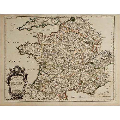
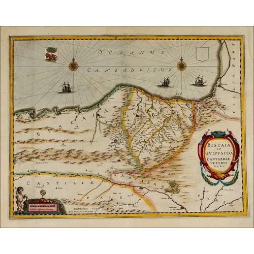
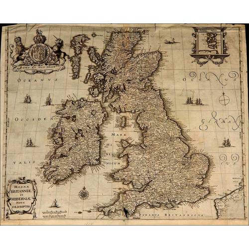
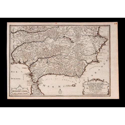
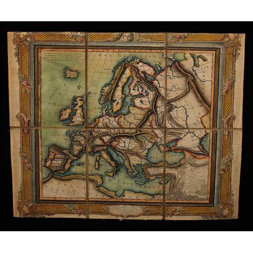
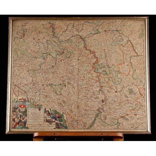
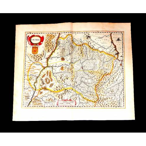
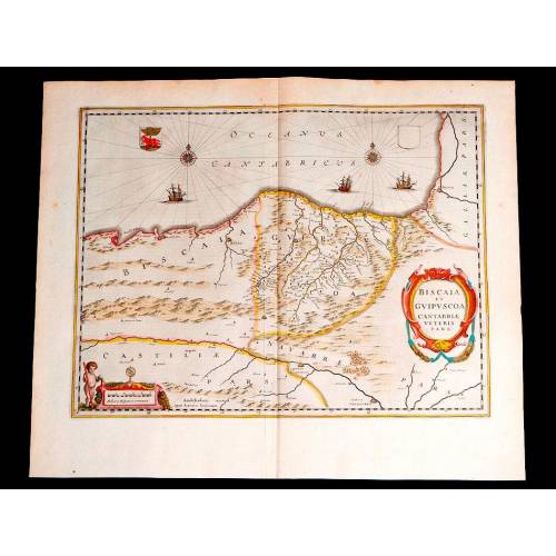
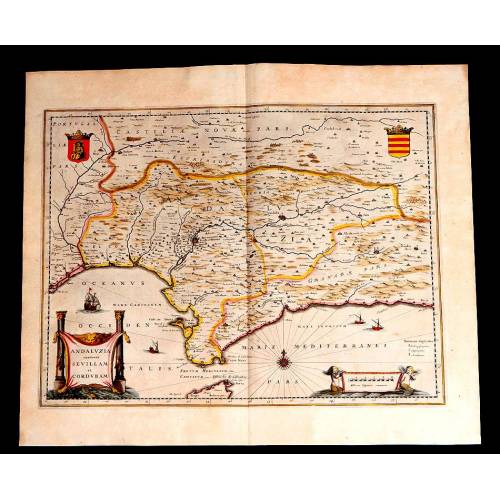
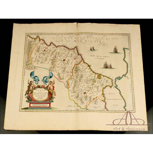
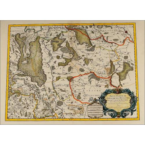
Impressive incredible Dutch atlas with a compilation of engravings of maps edited by Nicolas Visscher in 1670. It is a highly valuable book that would deserve to belong to a prestigious museum or library.Its author is Nicolas Visscher (1618-1679). The Visschers were acknowledged as relevant map engravers and editors, being among the best Dutch map engravers of the 17th century. The dynasty started with Claes Jansz Visscher (1587-1652), who made the copper plates to print the maps. He was succeeded by Nicolas, who made the maps that make up this atlas from his fathers copper plates. After him, Nicolas III (1649-1702) continued his father and grandfathers task and when he died, his widow Elizabeth kept on publishing maps until her decease in 1726. The Visschers are commonly regarded as second only to Willem Janszoon Blaeu among Dutch map-makers of the time. Their maps and atlas are high quality pieces, greatly beautiful and with enormous geographical accuracy. They are currently considered real works of art.This great atlas has 23 engraved and colored maps. 20 are intact and in excellent condition while the other 3 are well preserved but show water stains. In origin the atlas had 56 maps in all, but only the current eighteen ones have come to us. The rest were probably sold as individual pieces before we found it.Some maps are colored by hand and we know they are real. The maps are embellished with wonderful etched drawings with mythological characters holding inscriptions with the Latin name of the region they depict, the scale and another relevant data. We can also see in them the engraver and publishers name, Nicolaum Visscher.A complete atlas of Nicolas Visscher is valued between 50,000 and 80,000 euros. The full amount of the individual maps contained in this particular atlas is between 12,000 and 14,000 euros. The price of 7,000 euros, is only part of its value. A great opportunity for any collector.This wonderful atlas is a real true marvel of the 17th centurys cartography. Its beauty, quality and high value turns it into a museum piece, deserving to belong to a great expert in antique books and maps.Measurements: Width: 630 mm. Height: 530 mm.The remaining maps are:- Nouvelle Carte Geographique De La Partie Meridionale De France Contenant Le Gouvernement De Guienne Et Gascongne Le Lyonnois, Le Haut Et Bas Laguedoc, Le Dauphine, La Provence, Et Una Grande Partie De La Lombardie. Colored map depicting the Southern part of France. With water stains. Etching measurements: 47 x 78 cm. Price: 400.- Le Comté DArtois, el des Environs Detailed large map of the northeast region of Artois in France with the Straits of Dover, reaching to Abbeville, Arras, Lille and Dunkerque. Cartouche supported by cherubs. With water stains. Etching measurements: 49 x 89 cm. Price: 450.- Le Comté DArtois, el des Environs. Continuation of the previous map. Sample traces of moisture. Gusset with legend supported by cherubs. With water stains. Etching measurements: 49 x 89 cm. Price: 450.- Flandriae Comitatus Pars Occidentalis..Map of North West Flanders containing the French region along the Channel bordering and reaching into Belgium, including Dunkerque, Nieuwpoort, Ieper, St.Omer and Gravelines. Etching measurements: 51 x 56 cm. Price: 600.- Flandriae Comitatus Pars Septentrionalis. Map of Northern Flanders (Belgium). With Bruges city in the center. Etching measurements: 56 x 49 cm. Price: 400-600.- Flandriae comitatus pars orientalis: in Burg-Graviat, Gandavensem comit Alostanum Balliviat Wasiensem. Map of Eastern Flanders (Belgium). Etching measurements: 58 x 49 cm. Price: 500-600.- Flandriae Comitatus Pars Australis. A superbly engraved depiction of Southern Flanders, centered on Lille, and reaching to Menen, Tournai, Valenciennes, Arras and Bailleul. The cities and topography are shown pictorially, a miniature plan representing the fortified cities. Etching measurements: 55 x 49 cm. Price: 400-600.- Flandriae Comitatus Pars Australis. Map of Southern Flanders (Belgium). Etching measurements: 46 x 56 cm. Price: 400-600.- Flandriae comitatus pars Batava tam in ejusdem subjacentia quam vicina territoria. Map of Belgium. Etching measurements: 50 x 56 cm. Price: 500-750.- Antuerpiensis pars Meridionalis una cum Mechiniensi dominio in ejusden ditiones subjacentes accuratissime divisa. Map of Southern Antwerp. Etching measurements: 57 x 50 cm. Price: 500-700.- Brabantiae Batavae pars orientalis, comprehendens Tetrarchiam sive majoratum sylvaeducensem in ejusdem subjacentes ditiones. Map of North West Brabant, currently Belgium. Etching measurements: 57 x 50 cms. Price: 400-600.- Brabantiae Batavae pars occidentalis : sive Antuerpiensis tetrarchiae pars septentrionalis comprehendens Baroniam Bredanam marchionatum Bergensem ad Zoman. Map of the west region of Brabant, currently South West Netherlands. With relief shown pictorially. Etching measurements: 50 x 57 cm. Price: 500-600.- Leodiensis episcopatus pars septentrionalis, comprehendens comitatum Lossensem et Hornanum. Map of the Southern part of Liège (north east Belgium). Etching measurements: 50 x 57 cm. Price: 500-600.- Groningae et Omlandiae Dominium vulgo de Provincie van Stadt en Lande. Map of Groningen (currently part of the Netherlands) and Omlandie (Belgrado at the present day). Etching measurements: 50 x 57 cm. Price: 400.- Transisalania Provincia vulgo Over-yssel. Map of Transisalania (Overijssel ), Central-West part of the Netherlands with relief shown pictorially. With a decorative cartouche showing a fisherman. Etching measurements: 56 x 44 cm. Price: 500.- Ducatus Geldria et Zutphania Comitatus. Map of Gelderland, currently Central-West Netherlands. Etching measurements: 56 x 46 cm. Price: 500-600.- Generalis Lotharingia ducatus tabula. Map of Lorraine in North-East France. Etching measurements: 61 x 56 cm. Price: 600.- Superioris Alsatiae nec non Brisigaviae et Suntgaviae geographica tabula, in qua subjacentia territoria distincte ostenduntur, ex conatibus. Large map of the Alsace region and the Rhine River valley. Includes the fortified cities of Colmar (currently in France), Freiburg (currently in Switzerland), Breisach (currently in Germany), Basle and Schaffhausen (Switzerland). Etching measurements: 56 x 46 mm. Price: 400-500.- Nieuwe Kaart van t 'land Donawert en Hochstett. Map of part of the Danube and three views of cities with relief shown pictorially: Donauwörth (Germany), Hochstett (France) y Augsburg (Germany). Medidas de impresión: 48 x 40 cm. Price: 400.- Slesvicensis Ducatus Incolis Das Hertzogtum Schleswieg. Large map of the Duchy of Schleswig. Also showing the North Frisian islands (Föhr, Sylt, Amrum, etc.) and covering parts of the Danish Islands east as far as Lolland. Etching measurements: 87 x 50 cm. Price: 900.- Exactissima Tabula qua tam Danubii Fluvii Pars Inferior, a Belgrado Urbe usq ad ejus ostia, et minores in eum influentes, Fluvii quam Regiones adjacentes, ut Transylvania, Valachia, Moldovia, Bulgaria, Bessarabia et Romonia, aliiq Ucraniae ac Podoliae. Map of the down part of the Danube region with the city of Beograd, the tributary rivers and the stated subsidiary regions. Etching measurements: 59 x 48 cm. Price: 600.- Exactissima totius Archipelagi nec non Graeciae Tabula. Map of Greece. Etching measurements: 55 x 46 cm. Price: 600.- Magni Turcarum domini Imperium in Europa, Asia, et Africa. Large map of the Great Turkish Ottoman Empire in Europe, Asia and Africa and regions of influence. Etching measurements: 84 x 49 cm. Price: 1200.
26 other products in the same category:
-
Important Antique Otto Herkt...
-
Beautifully Preserved Antique...
-
Antique Map of 1720 by C....
-
Beautiful Map, Original 1665,...
-
Beautiful Map of the Spanish...
-
Magnificent Antique Engraving...
-
Detailed Map of Southern...
-
Antique Folding Map of Europe...
-
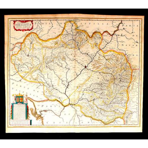
Antique Map of Aragon, 1638
-
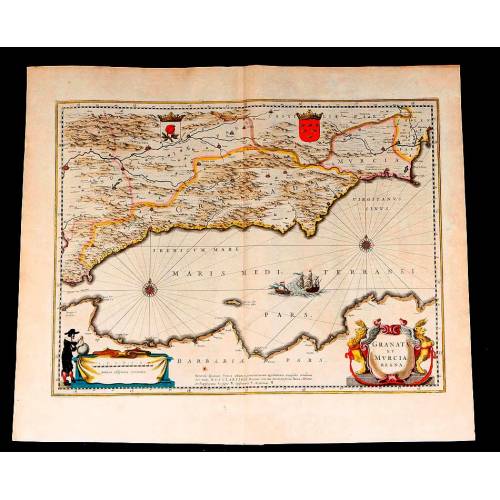
Map of Granada and Murcia...
-
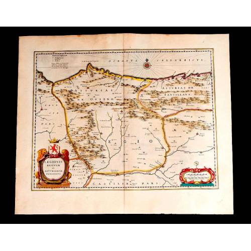
Map of Leon and Asturias....
-
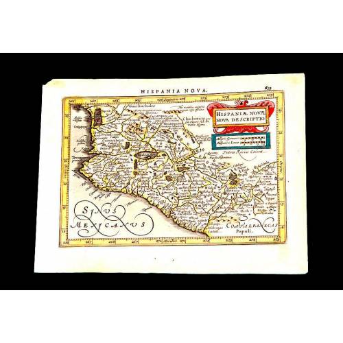
Antique Map of Mexico, 1628.
-
Magnificent Map of the...
-
Map of Navarra Antique. 1638
-
Antique Map of Vizcaya and...
-
Antique Map of Andalusia, 1638.
-
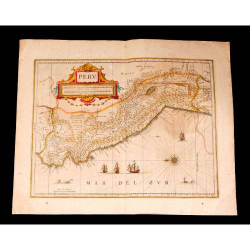
Antique Map of Peru, 1638.
-
Antique Map of Brazilian...
-
Magnificent Antique Map of...
-
Antique Atlas with 19 Maps by...
-
Antique Columbus Globe. Made...
-
Antique Columbus Earth Globe....
-
Antique Columbus Worl...
-
Antique Adolf Mang World...
-
Antique Map of the Reign of...
-
Attractive Antique Map by...